by Alexandria Searls
This past fall, the Lewis & Clark Exploratory Center received grants from Crutchfield and from the Bama Works Fund of Dave Matthews Band to launch our Watershed Filmmaking and Mapping Workshops in 2023. With these workshops, we teach students how to document our rivers and streams, giving hands-on experience at our site at Trevillian’s Creek and on the Rivanna River. Afterwards, we combine the students’ films, words, and measurements into a StoryMap, some of them accessible to the public, depending on the privacy permission of the schools. Schools that want to extend their field trip into the classroom can construct their own StoryMaps with our guidance and examples.
The Lewis & Clark Exploratory Center has been mapping the Rivanna River with underwater cameras since 2015 (see story). At first, we concentrated on still photography, both in and out of the water, encouraging children to observe the natural world around them and to develop a sense of stewardship. Children’s observations led to the discovery of a fallen silt fence upstream at a construction site on Trevillian’s Creek. Students have also identified invasive species on the Rivanna, including a big bright orange coy, fat and swimming peacefully along the riverbank.
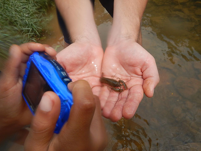
We teach the workshops for field trips during the school year and for camp programs in the summer. The workshops are adaptable for all levels, first through twelfth grade, and adult. The workshops can be reserved by any group.
Beginning in 2017, we worked on what would be the short film “A Portrait in Water,” which is an underwater map of the Rivanna River and one of its sources. The video contrasts the turbidity of the water at the source at Sugar Hollow with the turbidity at Darden Towe Park. “A Portrait in Water” won the Virginia Film Award at the RVA Environmental Film Festival in 2019, which took place at the Byrd Theatre in Richmond, and Best Experimental Film at the Carmarthen Bay Film Festival in Wales, also in 2019.
After “A Portrait in Water,” students were asked to make new video about the Rivanna River. They learned our documentation process of filming, taking notes, and identifying filming locations. Students were collaborators on “In the River’s Flow,” a film that examines the trash and other debris left behind in the river: plastic, an aluminum can, and a fishing bait container. “In the River’s Flow” has shown at the Denali National Park Educational Center, among other screenings.
ArcGIS StoryMaps became part of our workshops after our staff completed National Geographic’s course for educators, “Mapping as a Visualization and Communication Tool in Your Classroom.” This five-week class iss offered free along with other courses on geo-inquiry, plastics, and global warming, as well as on video, audio, and photography (those three are sponsored by Adobe). The mapping course introduced us to StoryMaps, and because our underwater cameras have GPS capability, going into that multimedia format for our workshops made sense. StoryMaps are the modern-day equivalent of Lewis and Clark’s journals, which included writing, drawings, plant specimens, and maps.
We examine the negative and positive aspects of exploration and documentation, both historically and in the present day; exploring in order to preserve the environment represents for us the best purpose for exploration. We combine environmental, cultural, and historical mapping, since environmental health is also connected to human use and history. For example, we have mapped the Rivanna River crossings in Thomas Jefferson’s time, and we also focus on current cultural events, such as the FLOW festival. The FLOW festival, conceived as part of the River Renaissance, features riverside dance, plein air painting, and site-specific sculpture.
Our StoryMap topics in 2022 included the paw paw stands at Darden Towe Park (because yes, we’re hoping to eat some paw paws), otters along the Rivanna, piece-by-piece documentation of the trash picked up by the Charlottesville Catholic School on a day of volunteering (a collaboration with LCEC and Albemarle County), the history of the name of the Rivanna River, and the photography work of our summer campers. Sometimes a StoryMap is an essay and a photograph; at other times it is film, journal notes, and a map. The media is chosen to best suit the subject.
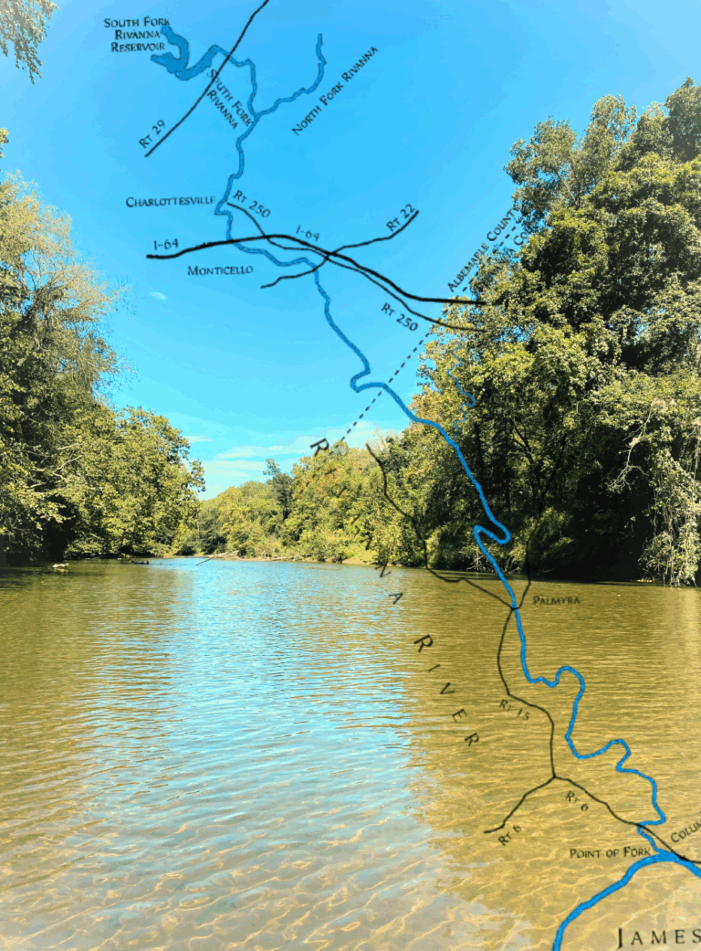
Meanwhile, our filming and photography of the Rivanna River continues throughout each season, as we document the shifting weather and flow patterns and the impacts of climate change, development, and environmental protection efforts. We regularly film the river at the Exploratory Center, but we also visit other locations, such as the dam at the South Fork Rivanna Reservoir, and across the river at Pen Park.
We invite community members to take part in our filming and mapping workshops and to help us build a digital and film library. We are also seeking ways to connect with the mapping projects of other organizations, and we welcome collaboration. Our mapping, because it involves the arts and personal stories, adds new dimensions to scientific observations and data.
If you would like to take a look at public examples of our mapping project, we’re on ArcGIS.com as LCECWaterMaps. Here are links to some of our StoryMaps:
On the name of the Rivanna River:
https://storymaps.arcgis.com/stories/ac625f05add54565b2b2425329cc75e2
On Otters:
https://storymaps.arcgis.com/stories/48635986f18246bd93cfe0e1b46dab34
On Paw Paws:
https://storymaps.arcgis.com/stories/ebf2d4ad53344c51ac917e112ddbafee
Our First Photography Watershed Workshops:
https://storymaps.arcgis.com/stories/06910ecd4901456ea5a1988e59442e70
Twelve Assignments in Underwater Video:
https://storymaps.arcgis.com/stories/a2710d2e98ef4f0cb6a1a0468de4af65
With increased funding, we hope to have a larger archive available to the public during 2023. Meanwhile, some of our films can be seen on my YouTube station, @alexandriaunderwater, or Alexandria Underwater.
A Portrait in Water https://youtu.be/JCXPg3IQ29Q
The Giving Sky https://youtu.be/VAWVW3xHTsI
In the River’s Flow is on Vimeo at https://vimeo.com/353709461
Please feel free to email with any comments, and if you are interested in being part of our Watershed Filmmaking and Mapping, please contact me at alexandriasearls@gmail.com We are also looking for ArcGIS support volunteers.