by MaeEllen Megginson, TJPDC Environmental Planning Intern
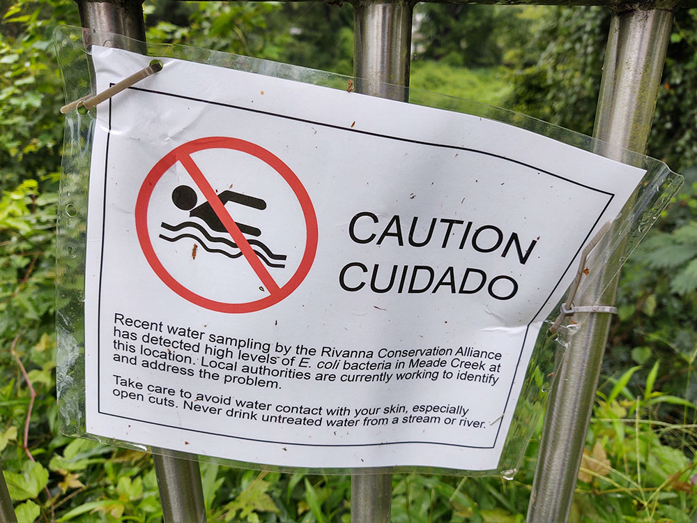
The Rivanna River Basin is home to a wealth of stewardship groups working to preserve and protect the watershed. These organizations engage in a range of activities such as stormwater management education, clean energy advocacy, stream monitoring, and tree planting. In regions with an abundance of stewardship activity such as the Rivanna River Basin, it is important that community members and leaders have a clear picture of existing stewardship networks to best leverage available resources.
A team at the USDA Forest Service Northern Research Station made this same observation in 2007 with the launch of MillionTreesNYC, an ambitious urban tree planting initiative aiming to bring one million trees to New York City within one decade. A program of this scale required a comprehensive understanding of where groups were operating and what work they were doing to make use of already established stewardship infrastructure. The Stewardship Mapping and Assessment Program (STEW-MAP) was born, creating a database of more than 500 stewardship groups working across the city.
STEW-MAPs visualize each stewardship group’s “turf”– the geographic area in which they work– as well as specific details about their activity and collaborative partnerships within a particular region. New York City’s STEW-MAP allowed organizers to utilize existing networks of stewardship groups, revealed where more support was needed and where there were gaps in stewardship activity, and showed potential opportunities for increased collaboration to reach lofty tree planting goals. The STEW-MAP and other tools allowed MillionTreesNYC’s millionth tree to be planted 2 years ahead of schedule.
From there, STEW-MAPs spread across the United States and globally to Central and South America, Europe, and Asia. The project also reached the Rivanna River Basin. In 2023, the Thomas Jefferson Planning District Commission (TJPDC) began developing a regional STEW-MAP to provide the public with information about what groups are participating in land and water stewardship work, where this work is happening, and how different groups are connected across the region.
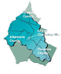
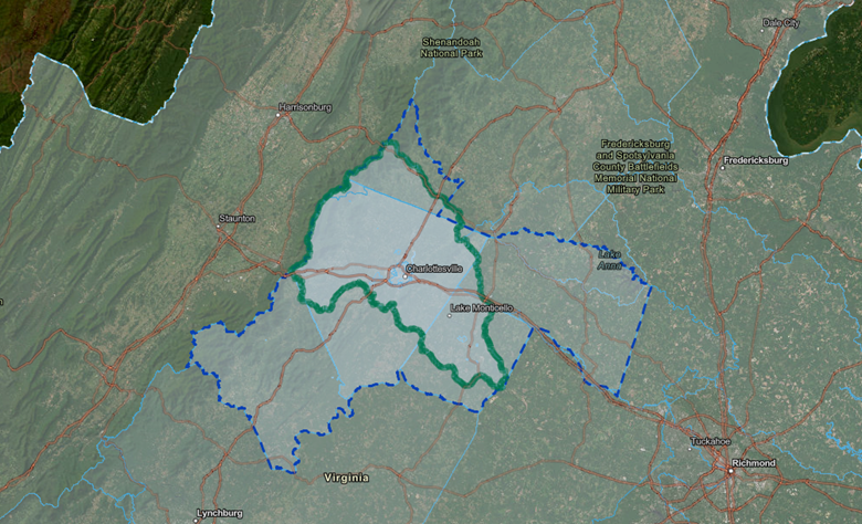
From April to September 2023, the TJPDC distributed a voluntary survey to known stewardship groups in the district. This dynamic region includes Greene, Albemarle, Louisa, Nelson, and Fluvanna Counties and the City of Charlottesville. Based on initial responses from stewardship groups, additional organizations these groups identified as partners were also invited to fill out the STEW-MAP survey.
Data was collected on groups’ site type, service type, and focus, as well as their turf and additional organizational details. All of these data were compiled to create the STEW-MAP TJPDC, which includes a geographic map of regional stewardship activity, as well as a series of network maps displaying the hundreds of connections between stewardship groups and their collaborators. These resources are all publicly available through the STEW-MAP TJPDC Dashboard.
Following publication, the TJPDC is considering ways to keep the STEW-MAP updated and effective. The TJPDC belongs to the Stewardship Community of Practice, a group of researchers and practitioners involved in stewardship work and STEW-MAP development in their communities across the globe. Membership in this group will allow for knowledge sharing and support continued adjustments to the STEW-MAP TJPDC as the region and the activity within it continue to evolve.
A STEW-MAP update is scheduled for 2026, which will reopen the survey and expand to recently created groups and those not included in the previous survey responses. New resources, such as a video tutorial for STEW-MAP Dashboard, are also being developed to make navigating the STEW-MAP TJPDC more accessible to the public. There is also more information available on the TJPDC website, including background on and benefits of the project.
In the meantime, there are many ways for community members to take advantage of the existing STEW-MAP TJPDC resources. Volunteers looking to get involved in their community can use the map to find groups of interest working in their own neighborhood. Community leaders can use the STEW-MAP to identify gaps in stewardship activity and find potential new avenues for collaboration.
In a region as active as the Rivanna River Basin, with dynamic ecosystems, expanding urban development, complex history, and a growing community interest in stream preservation and restoration, the STEW-MAP TJPDC allows local stewards to operate and collaborate most effectively. The importance of watershed protections is increasing, and community members and organizations are responding and organizing. The STEW-MAP TJPDC will continue to grow alongside the region and provide the necessary support to make stewardship efforts as impactful as possible.